
Page 7 - Spec Tech Vol 1 Issue 04
P. 7
SPACE SENSORS
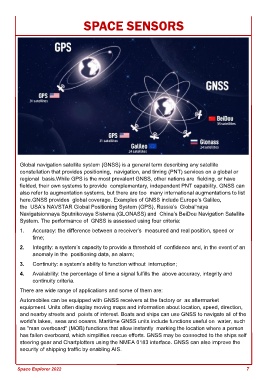
Global navigation satellite system (GNSS) is a general term describing any satellite
constellation that provides positioning, navigation, and timing (PNT) services on a global or
regional basis.While GPS is the most prevalent GNSS, other nations are fielding, or have
fielded, their own systems to provide complementary, independent PNT capability. GNSS can
also refer to augmentation systems, but there are too many international augmentations to list
here.GNSS provides global coverage. Examples of GNSS include Europe’s Galileo,
the USA’s NAVSTAR Global Positioning System (GPS), Russia’s Global'naya
Navigatsionnaya Sputnikovaya Sistema (GLONASS) and China’s BeiDou Navigation Satellite
System. The performance of GNSS is assessed using four criteria:
1. Accuracy: the difference between a receiver’s measured and real position, speed or
time;
2. Integrity: a system’s capacity to provide a threshold of confidence and, in the event of an
anomaly in the positioning data, an alarm;
3. Continuity: a system’s ability to function without interruption;
4. Availability: the percentage of time a signal fulfills the above accuracy, integrity and
continuity criteria.
There are wide range of applications and some of them are:
Automobiles can be equipped with GNSS receivers at the factory or as aftermarket
equipment. Units often display moving maps and information about location, speed, direction,
and nearby streets and points of interest. Boats and ships can use GNSS to navigate all of the
world's lakes, seas and oceans. Maritime GNSS units include functions useful on water, such
as "man overboard" (MOB) functions that allow instantly marking the location where a person
has fallen overboard, which simplifies rescue efforts. GNSS may be connected to the ships self
steering gear and Chartplotters using the NMEA 0183 interface. GNSS can also improve the
security of shipping traffic by enabling AIS.
Space Explorer 2022 7